Pole top photography - Summer 2023 - 24

Pole top photography – Summer 2023-24
From November 2023 to January 2024, we used a low-flying helicopter to take photos of 36,600 rural power poles across our electricity network. This work allowed us to find and fix any problems and help keep your lights on.
Thank you for your patience and understanding while this essential work was carried out.
Areas where the helicopter operated
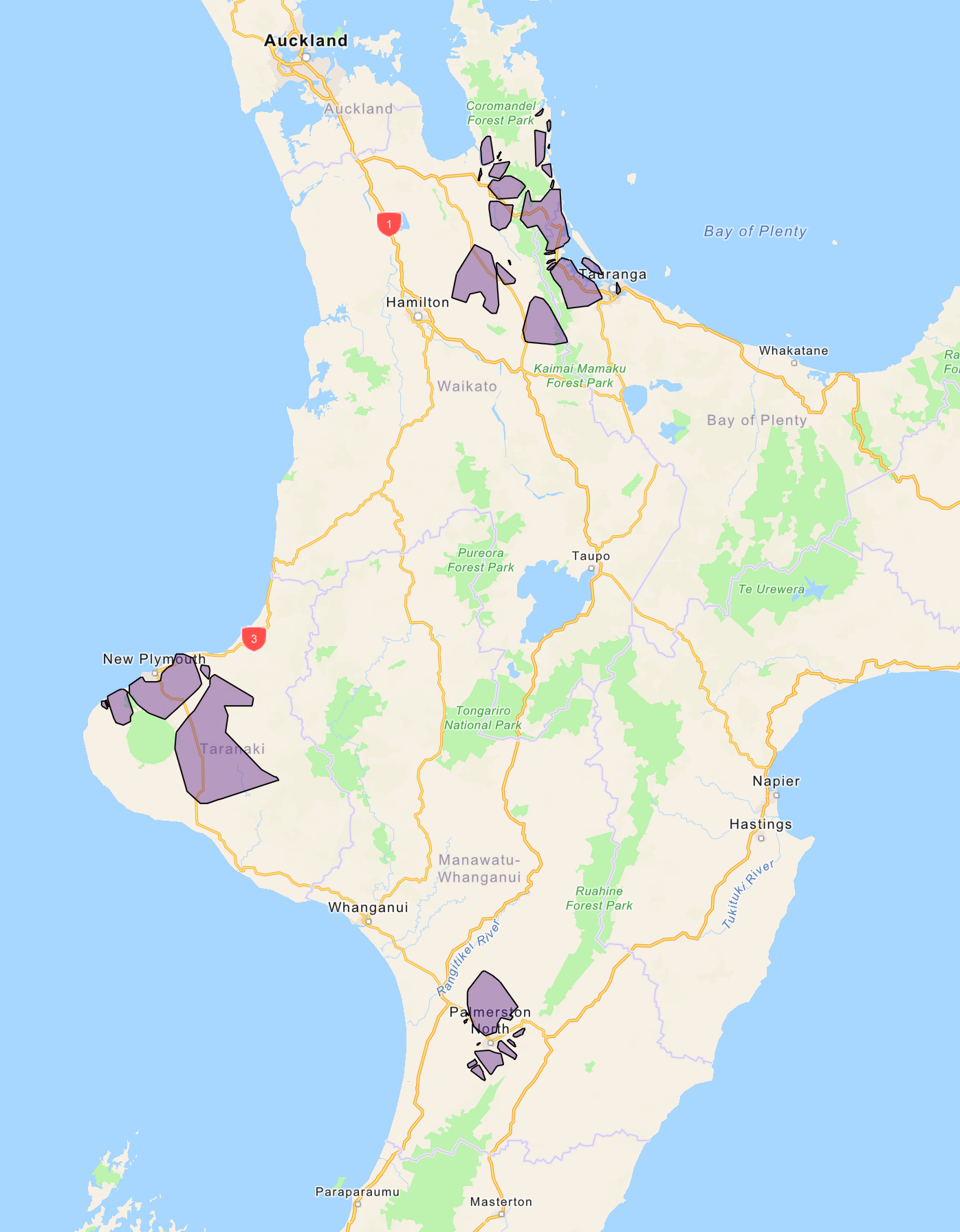
The work was carried out in stages, starting in the Bay of Plenty, Coromandel, Manawatū and finishing in Taranaki. The flight areas are indicated by the purple blocks on the map – these are a general guide only.
Thank you to those customers who contacted us to check if your specific address was impacted. We know helicopter noise can unsettle some animals, so we do all we can to work with you to help reduce impacts to animals.
Contact our team
FAQs
Per Civil Aviation Authority (CAA) requirements, the helicopter will only be flying in open air space. That means it will fly above 1,000 feet in urban areas, and above 500 feet in rural areas.
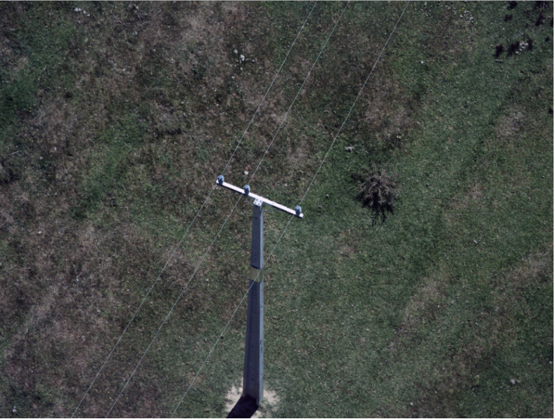
Your privacy will not be impacted by our survey work. We are only taking photos of our poles and crossarms, not residential properties. The photos are for internal asset assessment purposes only and are held in a secure location. Here is an example of the type of photos taken:

There are a few reasons we don't use drones:
-
drones available on the commercial market are not big enough to support the equipment required to carry out the type of work we're doing.
-
drones lack the ability to provide us with the quality and range of photographs we require to assess our assets.
-
drones can only last for a short period in the air before they need to be charged. It would require someone to travel with it on the ground across the network, which would be inefficient. A helicopter can run for several hours and cover much greater distances.
Aethon Aerial Solutions, who will contract local pilots to carry out the work.
Our electricity network stretches across the North Island, made up of about 264,000 poles. It is impossible for us to survey all of these in one summer, so we’ve been spreading out the surveys since 2018.
Once we have captured images of every rural pole through our surveying, we will likely move to routine inspections every one to two years.

